TOPEX/Poseidon: Perspectives on an Ocean Planet
 Ocean Topography


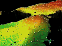
Ocean topography is the changing height of sea level relative to the earth's geoid after variations due to tides have been subtracted. While patterns of the ocean's currents have been charted by sailors for hundreds of years, TOPEX/Poseidon is the first space mission that allows scientists to use ocean topography to calculate the speed and direction of ocean currents almost everywhere in the ocean, much in the same way meteorologists use maps of atmospheric pressure to calculate the speed and direction of winds. With maps of ocean topography, scientists can observe in detail the movement of water through the worldÕs oceans. In the northern hemisphere, ocean currents flow clockwise around the highs of ocean topography and counterclockwise around the lows; this process is reversed in the southern hemisphere. These highs and lows are the oceanic counterparts of similar circulation systems in the atmosphere.


![]()